Sociometer - Methodology and Case of Study on Pisa and Florence
From Call Detail Rcord to Call Profile
A call detail record (CDR) is a data record produced by a telephone exchange or other telecommunications equipment that documents the details of a telephone call or other communications transaction (e.g., text message) that passes through that facility or device. The CDR spatial coverage describes the distribution of the GSM antennas on the territory, which can be used to estimate the corresponding coverage.
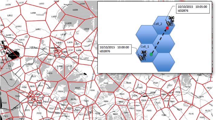
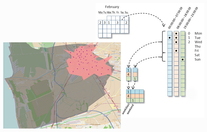
The call profile is a spatio-temporal aggregation representing the presence of a user in a certain area of interest during different pre-defined timeslots. A spatio-temporal profile codes the presence of a user in the area of interest in a particular time (or timeslot) identified by the information in the CDR. The idea is that if a person makes a call in the area A at time t, it means that the user is present in that area at that time.
Which kind of citizens?
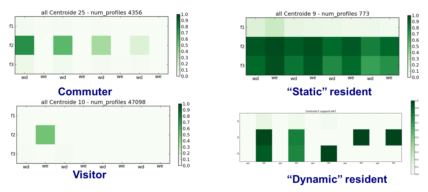
Exploiting the methodology called Sociometer it is possible to classify the users using the presence of cellphone users. Once the profiles have been created, the Sociometer classifies them implementing a set of domain rules that describes the mobility behavior categories. In particular we are interested to identify residents, commuters and visitors.
- A person is Resident in an area A when his/her home is inside A. Therefore the mobility tends to be from and towards his/her home.
- A person is a Commuter between an area B and an area A if his/her home is in B while the work/school place is in A. Therefore the daily mobility of this person is mainly between B and A.
- A person is a Dynamic Resident between an area A and an area B if his/her home is in A while the work/school place is in B. A Dynamic Resident represents a sort of “opposite” of the Commuter.
- A person is a Visitor in an area A if his/her home and work/school places are outside A, and the presence inside the area is limited to a limited period of time that can allow him/her to perform some activities in A.
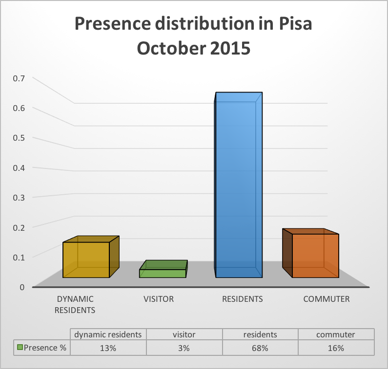
After the classification it is possible to analyze the composition of the city dividing the population into the 4 categories. In this case it is applyed on Pisa during the period of October-November 2015.
Understanding city influence
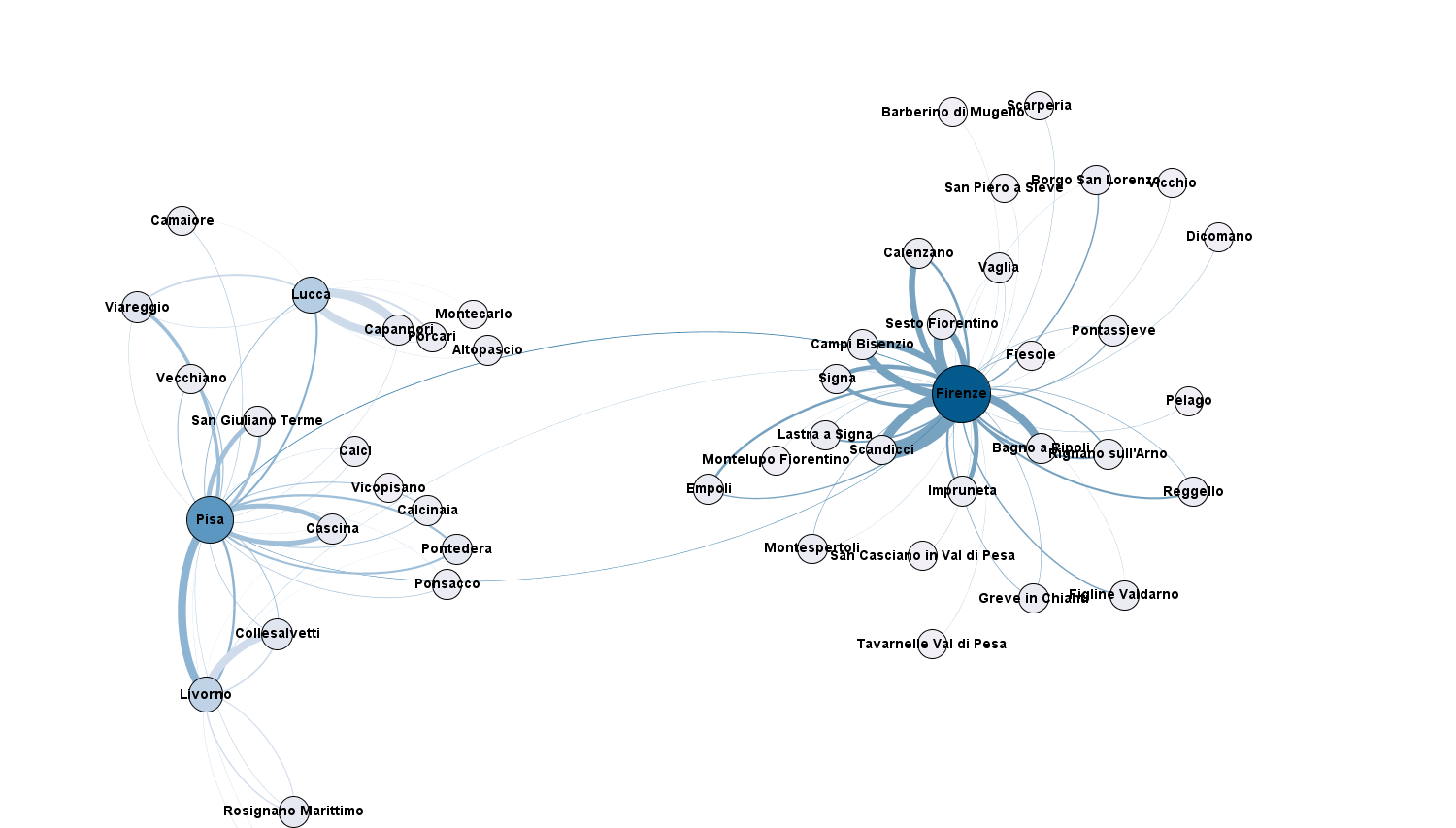
Analyzing the surrounding area of Pisa and Florence it is possible to understannd how the two cities influence the territory. In particular looking only to those users classified as Commuters we can see the backbone of the systematic traffic: people moving all the weekdays from outside Pisa and Florence to work and back.
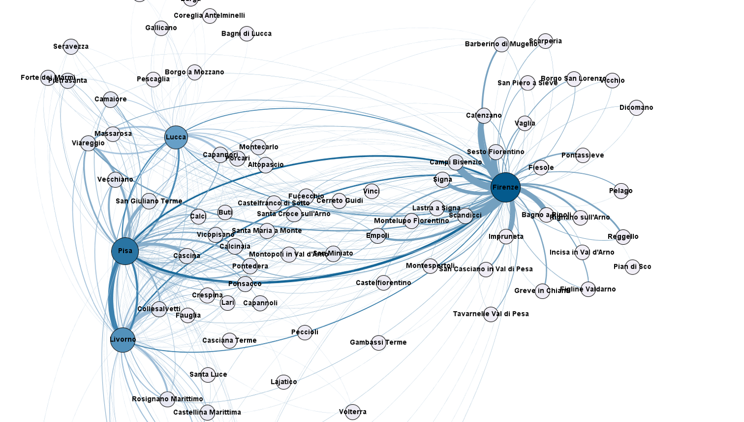
The same can be done with the Visitors obtaining a map of those movements which are not systematic and very difficult to capture with classical methods such as survey and official statistics even if they influence the traffic as weel as the systematic, especially in touristic cities.