Trajectory Builder - Methodology and Application on Pisa and Florence
Spatio Temporal Observations
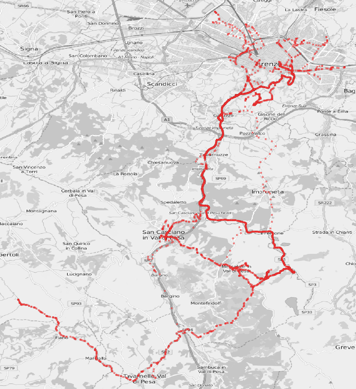
The tool builds trajectories from geo-located observations (e.g. GPS fixes) considering their temporal distribution. A trajectory is a meaningful representation of the movement of an object/user w.r.t. specific constraints. In the figure a set of GPS points recorded by an on-board device mounted on a private car is shown.
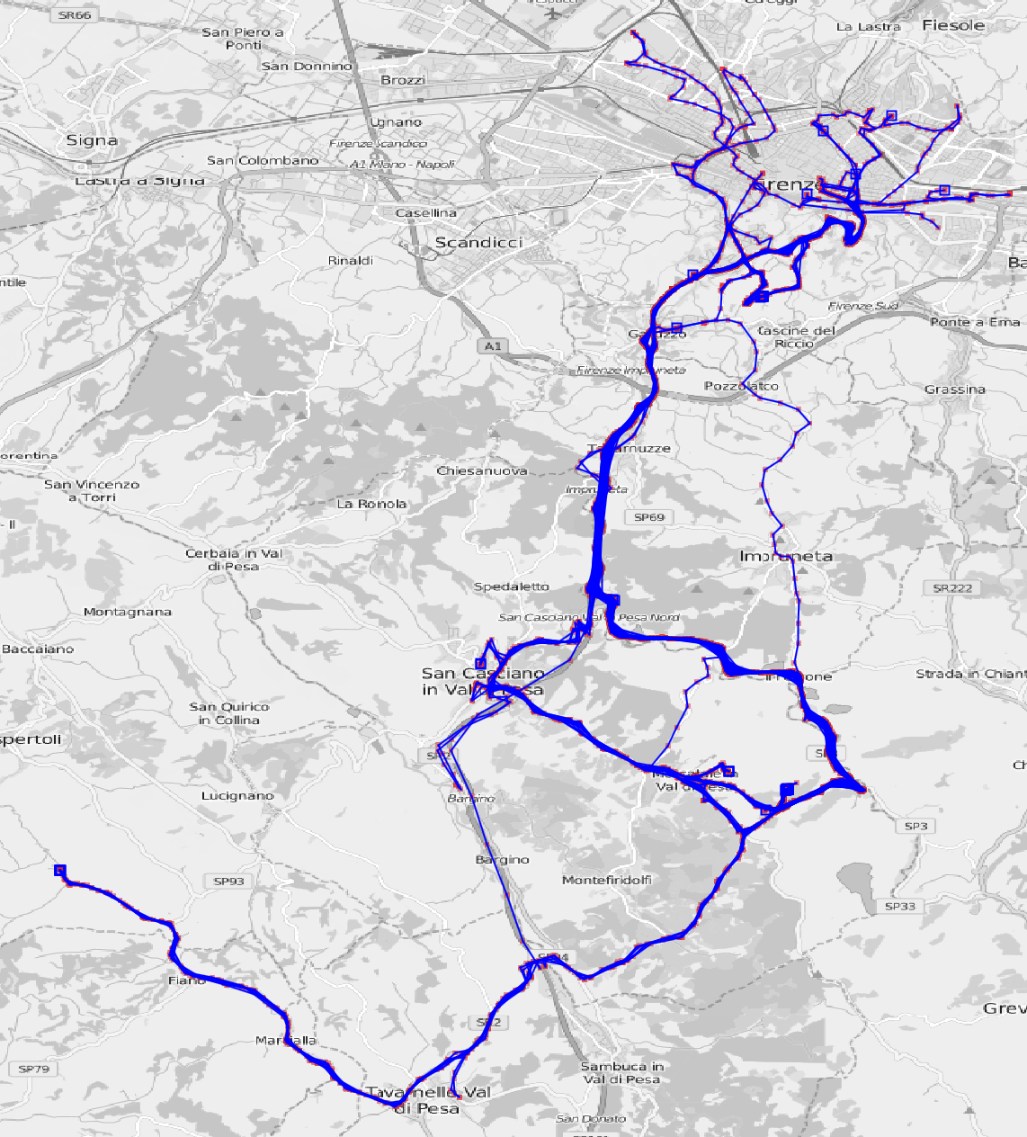
The result is a set of linestrings connecting points according to constraints. The tool provides a large set of constrainst such as: the minimum/maximum space gap between two points, the minimum/maximum time gap betwee two points, the maximum speed, etc. The analyst will be able to clean the raw observations and build the set of trajectories according to its needs.
Trajectory as semantic abstraction
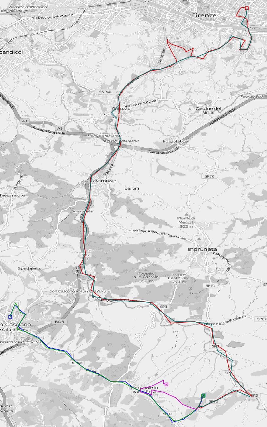
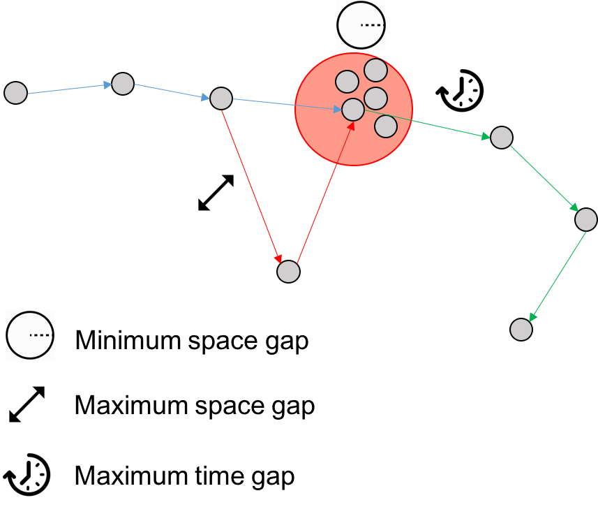
In the example on the left some of the trajectories extracted are depicted with different colors. The constraints used are the minimum space gap (i.e 50 meters), the maximum space gap (i.e. 2000 meters) and the maximum time gap (i.e. 1200 seconds). How those constraints affect the result is shown above: the blue trajectory connects the first three points, then due the maximum space gap skips a point and ends skipping a set of points which are too close each other to be considered relevant due the minimum space gap. The maximum time gap cut the trajectory strating the green one which connects the rest of the points.
This tool is the basic step for more complex analyses which will take advantage of the semantic enrichment obtained going from raw points to trajectories which is not simply a data cleaning but also the discovery of meaningful locations where the object/user stops.